
A hasty and unexplained early reopening of burned-out areas after the 2024 Bridge Fire makes this L.A. mountain paradise more vulnerable to the ravages of climate change.
An upside-down flag hanging from El Capitan in Yosemite. Historic structures reduced to ashen rubble at the Grand Canyon. A critical shortage of plow truck drivers at Crater Lake in Oregon.
These have been the most obvious signs of crisis for federal recreational lands under the Trump administration. But as much as we may worry about those national crown jewels, the federal government’s management of the Angeles National Forest, within easy driving distance of 18 million residents of the greater L.A. metro area, matters much more to our daily lives.
In June, almost a year ahead of when it was first scheduled, the U.S. Forest Service abruptly lifted a closure order for more than 56,000 acres that burned in the September 2024 Bridge Fire. And when I say abruptly, I mean out of the blue: The closure, set to expire in May 2026, was canceled with a one-sentence letter signed by the local forest’s superintendent: “Effective June 20, 2025, Order No. 05-01-25-12 … is terminated.”
That was it — no press release, no hint that hiking on unstable hillsides might be dangerous, no warning that trekking over still-freshly burned landscape could permanently damage fragile, recovering wildlife habitat and vegetation.
I’ve hiked in the San Gabriel Mountains most of my life. I know how heartbreaking it is to look north from the L.A. basin and see smoke rising in the distance. I also know how frustrating it is to be told to stay away from my favorite trails for what seems like an eternity after a fire.
So trust me when I say that terminating the Bridge Fire closure order after less than a year represents a dramatic and deeply troubling departure from the post-fire management of the past.
Similar orders after the 2009 Station Fire (which burned 161,000 acres, more than the city of Chicago’s total land area) and the 2020 Bobcat Fire (116,000 acres) were lifted bit-by-bit over several years — yes, several years, not months — to allow time for managed recovery and repair.
By many accounts, that didn’t happen after the Bridge Fire, which stretched from the mountains north of Claremont to Wrightwood. Some volunteers who expressed shock at the closure’s termination — because such orders typically get extended, not cut short — told me they hadn’t even been allowed into burn areas to repair trails.
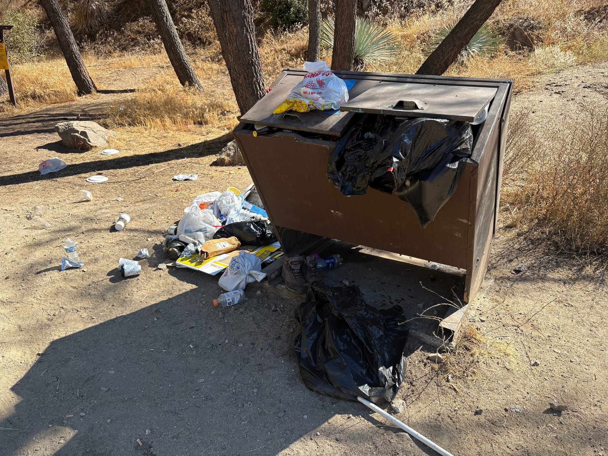
When I explored the East Fork of the San Gabriel River five days after the closure was lifted, I encountered overgrown, unstable trails that should have remained off-limits. Subsequent visits in September didn’t inspire confidence. Trash cans overflowed and evidence of illegal campfires abounded. Though some trails had been repaired, bathrooms at a popular vista point outside Wrightwood remained burned and closed.
Whatever the reason for the closure termination — and I tried to get an answer, but my repeated requests for comment from an Angeles National Forest spokesperson, by email and phone, were not returned — one thing is certain: The shift toward what appears to be haphazard forest management couldn’t come at a worse time.
Climate change has been wreaking havoc on forest recovery as it is. If anything, post-fire closures should be longer. Experts I talked to said reopening burned areas prematurely can hasten and intensify the unwelcome changes already in store for the San Gabriel Mountains.
That includes the die-off of pine, spruce and fir trees, said Hugh D. Safford, a wildfire researcher at UC Davis and former U.S. Forest Service ecologist. He has warned about the changes unfolding in forests throughout California in the coming decades, including the “very high risk” of the nearly complete loss of conifer forest in Southern California’s mountains “and the massive impacts this would have on ecosystems services and biodiversity.”

The climate-caused extinction of beloved pines and spruces from our local mountains may not come as news to nature-loving hikers in L.A. — unwelcoming and demoralizing, yes, but not surprising. But a similar fate may also await chaparral, the hardy plant community consisting mainly of dense, tough shrubs and short trees (such as manzanita and some oaks) adapted to survive drought and wildfire.
“Most chaparral is probably going to be gone [from L.A.-area mountains] in 100 years,” Richard W. Halsey, a former wildland firefighter and founder of the California Chaparral Institute, told me when asked about forest management and the ecological changes already underway. “You will probably have to go up to Santa Barbara to see chaparral.”
Mountain ranges without pine cones or manzanita? I’d say let’s hang the American flag upside down in the darkened, dead trees of the Angeles National Forest, but Lord knows the San Gabriels don’t need more trash or really any sign of human activity. What they do need is careful, steady management that prioritizes whatever recovery we can hope for.


